Use Virtual Camera to remotely & instantly monitor:
Use Virtual Camera to remotely & instantly monitor:
Crowded areas • Key infrastructure • Construction zones
• Crowded areas
• Key infrastructure
• Construction zones
Virtual Camera
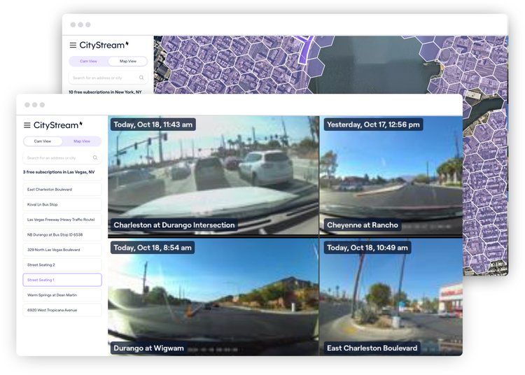
What is Virtual Camera?
With trillions of anonymized images generated from Nexar dash cams and analyzed using cutting edge AI, Virtual Camera lets you explore the physical world and gain insights like never before.
With trillions of anonymized images generated from Nexar dash cams and analyzed using cutting edge AI, Virtual Camera lets you explore the physical world and gain insights like never before.
The images you need, at all times of day
Explore the Physical World
View hundreds of US cities through fresh street-level images, taken recently by Nexar dash cams.
Travel in Time
Position virtual CCTV cameras to monitor specific points of interest over time.
Gain Insights
Automatically detect and map any object or change in the physical world with Nexar’s AI. Anything’s detectable. Try us.
How does it work?
Dash cams collect images
Nexar dash cam users anonymously contribute images from their drives
AI detects work zones
Nexar uses cutting edge artificial intelligence to detect work zone areas
Map detections
These detections are aggregated, localised and put on a map, making monitoring of changes easy